

Dubai completes Middle East’s first mobile mapping survey of waterways
High-precision 3D models developed in Al Jaddaf
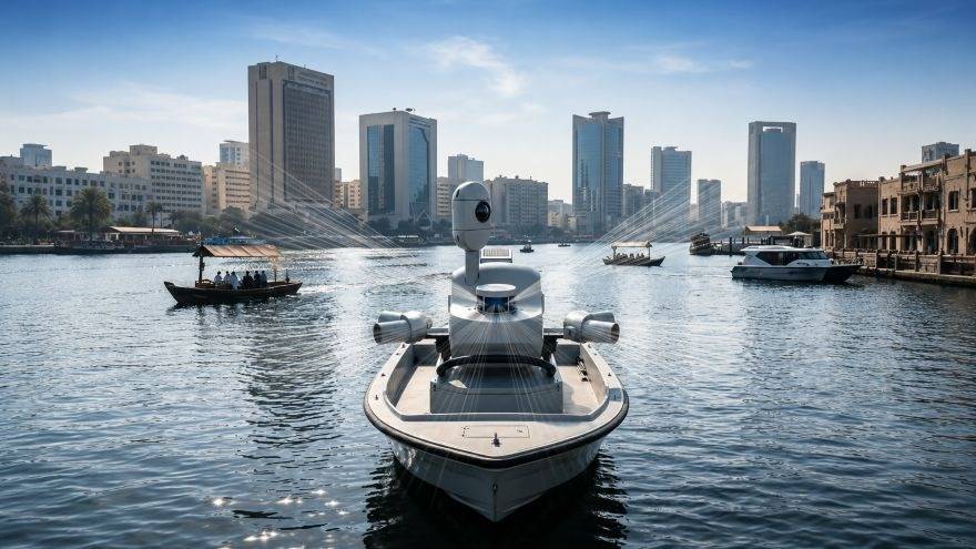
DUBAI – Dubai Municipality has completed the Middle East’s first pilot project for surveying waterways and canals using innovative Mobile Mapping technology, marking another milestone in the emirate’s drive to strengthen smart infrastructure and advanced urban planning systems.
The project utilised the Leica TRK mobile mapping system mounted on a specially equipped vessel to conduct high-precision surveys across Dubai Water Canal in Al Jaddaf. The initiative enabled the capture of highly detailed geospatial datasets and the creation of accurate 3D models designed to support infrastructure management and future urban development projects.
The achievement further enhances Dubai’s geospatial ecosystem, which is recognised among the world’s most advanced and efficient digital mapping systems. Officials said the continuously updated spatial data generated through the project will support vital sectors, improve asset management, and contribute to more sustainable city planning.
Smart mapping
The pilot project was carried out in collaboration with specialised partners and is expected to open broader opportunities for the use of advanced geospatial data across the emirate. Authorities said the technology can significantly improve the efficiency of monitoring waterways and surrounding infrastructure while supporting international best practices in urban management.
Eng Maitha Alnuaimi, Director of the GIS Centre Department at Dubai Municipality, said the initiative forms part of ongoing efforts to develop an integrated geospatial database that supports Dubai’s Digital Twin project.
She noted that the project would help government entities make accurate and timely decisions based on reliable data while reinforcing Dubai’s position as a future-focused smart city.
Next phase
Dubai Municipality said surveying works will continue to expand across waterways throughout the emirate in coordination with relevant authorities ahead of the project’s next operational phase.
The wider rollout is expected to strengthen the integration of smart systems and improve the resilience, efficiency, and sustainability of city management services.